Templar cave or 19th century folly

News media exploded the past few days over the ‘discovery’ of a 700 year-old cave in Shropshire, purportedly used by the Knights Templar. The entrance through a rabbit hole added some Alice in Wonderland qualities to the story.
When asked by Dutch newspaper Volkskrant, the photographer credited with the discovery said it must have been ‘a very obese rabbit’. He also didn’t discover the grotto, nor has he ever claimed as much: a youtube video alerted him to the existence of this grotto and inspired him to explore. Although many media also reported this, the lure of the Knights Templar story was too strong to ignore. Even the BBC could not restrain itself.
Caynton Caves in Shropshire

Nothing but a story it seems to be. Although the origin of the caves seems to be unclear, their existence was no secret: they were even closed off in 2012 because the grotto was vandalized and used by modern day ‘black ritual’ practitioners. Several people have photographed the grotto in previous years, as this album on flickr shows. The area was used as a quarry in previous centuries, and probably turned into a garden grotto for the family who built Cayton Hall between 1775 and 1803. The grotto itself is dated between 1800 and 1850, a description of Caynton Hall on ParksandGardens.org (created on 1 October 2008) tells us.

The story as presented in the media over the past days, was a hoax. Nothing like dropping terms like Knights Templar, Freemasonry, Illuminati and the like to get the juices flowing. Just ask Dan Brown. One wishes ‘regular’ garden history, and real discoveries, would create such an effect.
It did some good, though. The Caynton Caves wikipedia page is thoroughly updated over the past two days, with sources going back a few decades.

The house, its grounds, as well as the site where the grotto is located, are private property.


Summary

Zoals de Volkskrant vanmorgen al schrijft: berichten over een pas ontdekte Tempeliersgrot in Shropshire zijn een typisch geval van ‘een goed verhaal moet je niet doodchecken’. Ze deden het toch. Hoewel de oorsprong niet helemaal duidelijk is, lijkt het niet meer te zijn dan een fijne folly, gemaakt in een in onbruik geraakte steengroeve. Niets nieuws voor tuinhistorici.

Continue reading

Wegdam revisited

Six years ago I wrote a small piece about a peculiar elevation in the garden of Wegdam, near Goor in the Netherlands. A ‘hill’ I called it earlier, but it can’t be much more than 5 meters high. The problem at the time was that it was difficult to present my case,  partly because topographical maps did not indicate there wás an elevation before 1989.

Enter a source I have used earlier this year: the Actueel Hoogtebestand Nederland (AHN). That same technology shows the elevation at Wegdam in all its glory, as well as the ‘canal’ leading up to it from the road. 1This body of water is not coloured blue on the AHN, but the image shows where the ground level is lower.
This view immediately clarifies the point I was trying to make: that it was and is situated in the central axis leading into the garden from the front door. And thus must have been a deliberate part of the garden’s design.

Wegdam as seen on the Actueel Hoogtebestand Nederland (AHN). The central axis is indicated by the red dotted line.


Looking towards the northeast, the stretch of water would have lead the visitor’s eye between the buildings of a farm, further into the countryside. A turn to the west would have given a view of the house. It would have been a perfect belvedere. The questions from six years ago (when was the hill created -the AHN doesn’t solve that issue; was there ever a building or structure on top of it?) remain unanswered till this day. 2Provided I have not missed anything in a local publication.

The image above leads to a new question, though: near the top there is a junction of two roads, forming an irregular ‘cross’ sign with four arms. But the LIDAR imagery of the AHN shows at least five extra straight lines radiating from this junction. Could this be an indication the area has been used as hunting ground, with a sterrenbos as its centre? Maps over the past 200 years do not show this feature, which means that if this was a sterrenbos, it must have been older than that.

sterrenbos-carolinaberg-dieren

Aerial view of the Carolinaberg in Dieren, an example of a sterrenbos created for hunting purposes. It boasts 14 straight avenues radiating from the centre.

Footnotes

Footnotes
1 This body of water is not coloured blue on the AHN, but the image shows where the ground level is lower.
2 Provided I have not missed anything in a local publication.
Summary

Het Actueel Hoogtebestand Nederland geeft een duidelijk beeld van het bergje in de bosrand op Wegdam, nabij Goor. Er zijn elders hoogteverschillen te zien die erop lijken te duiden dat er ooit een sterrenbos kan zijn geweest.

Continue reading

Trees ahoy!

Two stories about trees floating in upright position appeared in the media this month: one related to something that has long been a traditional feature of park landscaping, the other as part of a climate change awareness project. They made me think of an earlier example.

The traditional story comes from Georgia (see this BBC coverage), where a new park is laid out by former prime minister Bidzina Ivanishvili. To give his park more ‘body’, mature trees are imported from elsewhere -nothing new in landscape architecture. One of these trees, a Tulip tree of around 100 years old, was uprooted in the west of the country. Its transport by boat over the waters of the Black Sea provided images such as this:

March 2016 Tulip Tree transport

A 100 year-old Tulip tree is transported over the waters of the Black Sea.

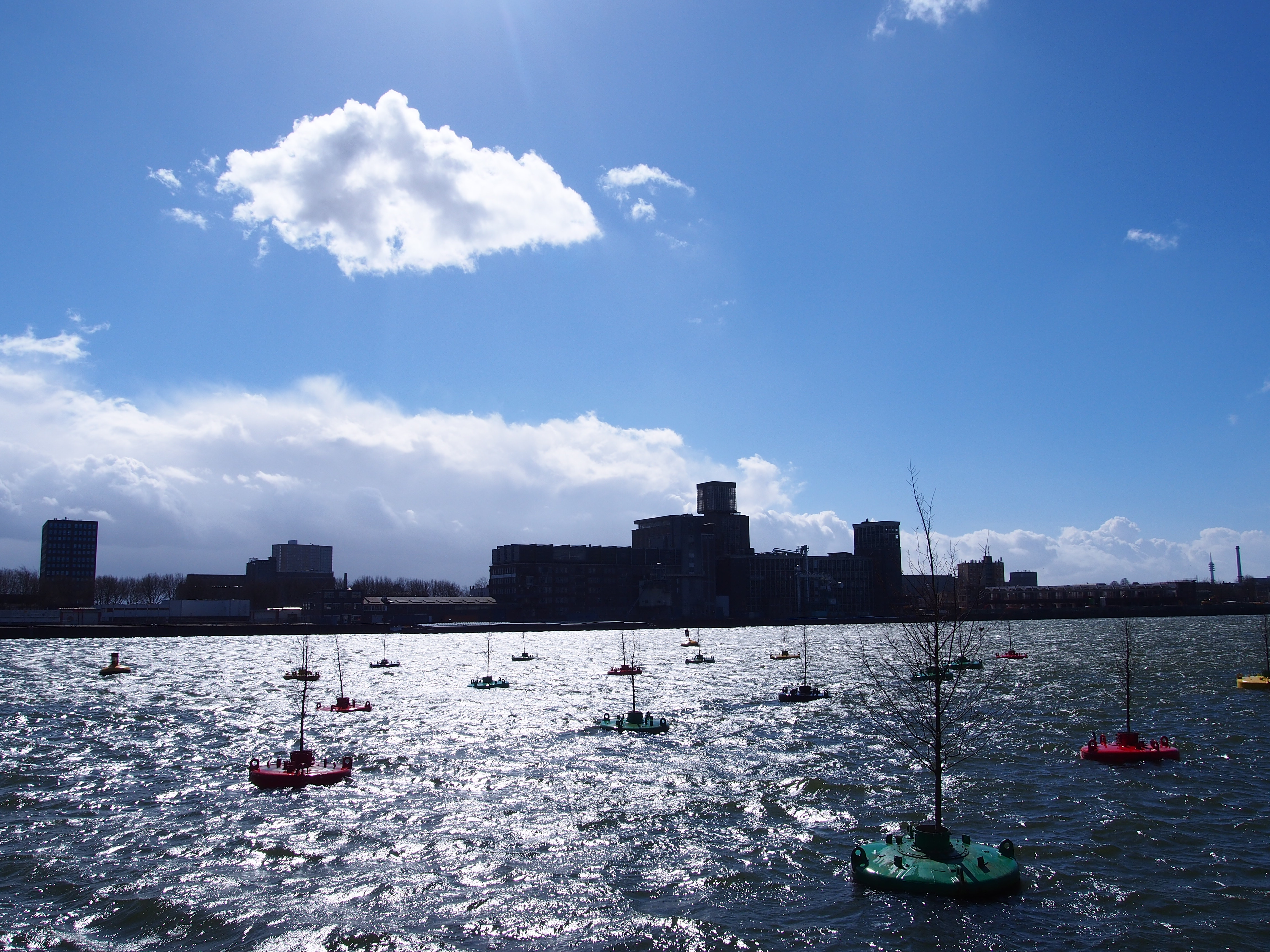
Closer to home, Rotterdam saw the eh… ceremonial launch of a Bobbing Forest in the former harbour basin Rijnhaven. This project by Rotterdam art production collective Mothership is inspired by and a cooperation with Columbian artist Jorge Bakker. It takes a somewhat light-hearted approach to problems associated with climate change: the predicted rise of sea levels and its possible consequences for low lying land -like Rotterdam and much of the Netherlands. Even in today’s storm, the trees seem to cope well with the conditions.
Bobbing Forest

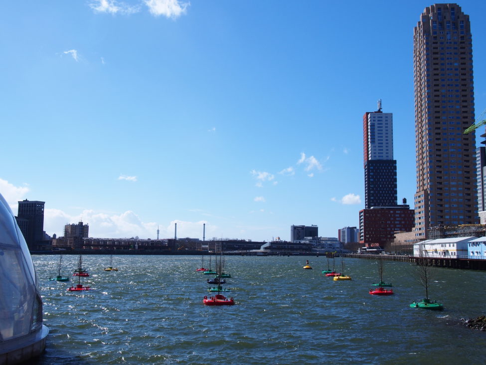
The Bobbing Forest in the Rijnhaven. (photos: HvdE).

Pliny the Elder
Both stories made me think of what Pliny the Elder wrote about this part of the world.1Gaius Plinius Secundus, Naturalis Historia, XVI.2.1. Quoted in: Geert Mak, Ooggetuigen van de Nederlandse geschiedenis in meer dan honderd reportages (Amsterdam 2005), p36-37. According to some sources Pliny was in the area of modern Leiden in AD 47, from where a canal between the rivers Rhine and Maas was made by Roman troops. At the height of their expansion into Northwestern Europe, the Romans managed to occupy the southern half of  what is now the Netherlands. The larger rivers running towards the North Sea formed a natural boundary along which the border (the ‘limes‘) was formed. The river Rhine was also an important trade route. Peoples living to the north were hostile to the Roman occupation, and they often successfully defended their territory against Roman attacks -in which Pliny himself was involved.2Pliny -whether inspired by frustration or disbelief about their resistance to the superior life style of the Romans- described these people as living in swamps, constantly under threat from flooding, being pushed back to (scarce, and often self-built) higher ground for most of the year. To warm themselves they burned dried ‘mud’ (peat), which, according to Pliny, was dried more by the strong winds than by the warmth of the sun.
Pliny was writing about the Chauci, living between the Weser and the Elbe rivers in modern Germany. But the Chauci traveled westward during Pliny’s lifetime, and were environmentically and culturally strongly related to the Frisii, who lived in the northern part of the Netherlands.
To defend themselves against attacks from the north, the Romans created army camps along the border, and they had ships patrolling the rivers.
Pliny notes that at several occasions, Roman sailors thought they were being attacked by enormous enemy ships. In reality, their rigging was wrecked by mature trees, standing on islands floating down the river.3As he wrote: Many is the time that these trees have struck our fleets with alarm, when the waves have driven them, almost purposely it would seem, against their prows as they stood at anchor in the night; and the men, destitute of all remedy and resource, have had to engage in a naval combat with a forest of trees!
Boggy soil, cut loose by high and/or fast floating waters created the islands, only held together by the roots of the trees growing upon them.
 It must have been a majestic sight to see these trees float towards and onto the sea, comparable with the Tulip tree transport on the Black Sea.

Like the Roman attempts to occupy new territory, the Georgian ‘tree grab’ leads to protests from the locals, who may not be satisfied with the promised replanting of trees for compensation. Collecting mature trees from elsewhere for the benefit of a few individuals is not as acceptable as it seems to have been during the 19th and early 20th centuries, when this was fairly common practice among estate owners and landscape architects. That ‘climate’ seems to have also changed.

2000 years

The Rotterdam project is planned to run between five and ten years, but I think that period should be expanded, provided the elm trees can reach some form of maturity in this environment. We could create a modern version of these ancient floating forested islands by cutting loose bobbing forest in a few decades from now. For example in 2047, exactly two millennia after Pliny supposedly roamed these parts and must have heard his soldiers tell those stories.
I like to think this would both commemorate an important period of our history, and be a strong reminder that climate change played a significant role in the decline and fall of the Roman empire.4Provided we still need this reminder by that time. The Frisii were also forced to leave most of their territory in the fourth century AD, because of flooding caused by… rising sea levels.

Rijnhaven Rotterdam

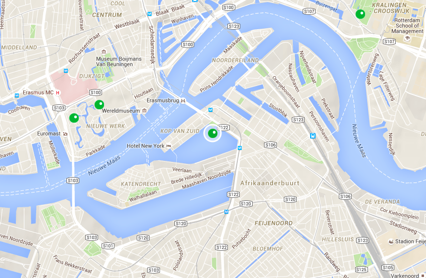
Location of the Bobbing Forest project in the Rijnhaven in Rotterdam.

Footnotes

Footnotes
1 Gaius Plinius Secundus, Naturalis Historia, XVI.2.1. Quoted in: Geert Mak, Ooggetuigen van de Nederlandse geschiedenis in meer dan honderd reportages (Amsterdam 2005), p36-37. According to some sources Pliny was in the area of modern Leiden in AD 47, from where a canal between the rivers Rhine and Maas was made by Roman troops.
2 Pliny -whether inspired by frustration or disbelief about their resistance to the superior life style of the Romans- described these people as living in swamps, constantly under threat from flooding, being pushed back to (scarce, and often self-built) higher ground for most of the year. To warm themselves they burned dried ‘mud’ (peat), which, according to Pliny, was dried more by the strong winds than by the warmth of the sun.
Pliny was writing about the Chauci, living between the Weser and the Elbe rivers in modern Germany. But the Chauci traveled westward during Pliny’s lifetime, and were environmentically and culturally strongly related to the Frisii, who lived in the northern part of the Netherlands.
3 As he wrote: Many is the time that these trees have struck our fleets with alarm, when the waves have driven them, almost purposely it would seem, against their prows as they stood at anchor in the night; and the men, destitute of all remedy and resource, have had to engage in a naval combat with a forest of trees!
Boggy soil, cut loose by high and/or fast floating waters created the islands, only held together by the roots of the trees growing upon them.
4 Provided we still need this reminder by that time. The Frisii were also forced to leave most of their territory in the fourth century AD, because of flooding caused by… rising sea levels.
Summary

Twee berichten over drijvende rechtopstaande bomen in een maand tijd, herinnerden mij aan een verhaal over met bomen begroeide drijvende eilanden uit een van de vroegste geschreven bronnen over Nederland. Een project in Rotterdam brengt op deze manier niet alleen de gevolgen van de huidige klimaatverandering onder de aandacht, maar vormt in dat licht bezien mogelijk een herinnering aan de gevolgen van klimaatverandering voor het eens zo machtige Romeinse rijk -en dat van Nederland.

Continue reading

Published: Adriaan Snoek at 18th century Westerhout

My latest article is out in print, and it’s good to see the end result.1H. van der Eijk, ‘Westerhout in Haarlem – zes maanden werk voor Adriaan Snoek’, in: Arinda van der Does en Jan Holwerda (eds), Tuingeschiedenis in Nederland II: Denken en Doen in de Nederlandse tuinkunst 1500-2000 (s.l. 2016), p.105-114 (more info).
This publication doubles as Cascade bulletin voor tuinhistorie, Jaargang 2015 (24), nr. 2 and Cascade bulletin voor tuinhistorie, Jaargang 2016 (25), nr. 1, p105-114.
It concerns the design and layout in 1775-76 of the now lost gardens of Westerhout, in Haarlem.2Not to be confused with the still existing Westerhout in Beverwijk. Once bordering on the west side of the Haarlemmerhout (the large 17th century woodland of late mediaeval origin outside Haarlem’s former southern city gates), this relatively small garden was best known for its beautiful 19th century layout.3The provincial archive in Haarlem has a few excellent photographs in its collection of the garden at the end of that century.
fotoThe 18th century garden of Westerhout, however, has been completely forgotten. That is mainly due to the fact that roughly a century ago the garden has been fully redeveloped, and because plans or descriptions of the garden hardly exist. In this country that particular combination means: no research whatsoever is done.
But the extensive archives of the Brants family, the Amsterdam based merchant family who owned the estate at the turn of the 19th century, revealed some helpful sources to reconstruct developments in the garden around 1775:

  • an account from the architect with dates and work descriptions
  • the owner’s account book
  • dated bills from (sub)contractors or third parties
  • a nondescript overview of dates, names and numbers, often matching the other three sources and at times adding more detail

All combined, these sources provide information about the changes made in this garden over the course of a six month period in 1775-76. The account by architect Adriaan Snoek (1716?-1796) meticulously listed all of his work. It reveals the steps in his design process, it clarifies when he felt the need to be present in person, and which work he left for subcontractors.

Rococo
Snoek was a land surveyor who up till now was only known as a garden designer for two rococo gardens in the area between Haarlem and Leiden -one of which was most probably never executed.4Woestduin (1766), probably not executed; in 1761 Snoek drew two designs for Huis te Bennebroek, of which one was executed. That design, featured in the article, is the most modern of the two -yet still rococo. It is very probable that Snoek designed more gardens than the three found thus far. Design drawings for Westerhout have unfortunately not been found, but the remaining sources fill in the gaps in ways a drawing could never have done. The architects’ account is transcribed in full and included in the article.
Snoek’s design for Westerhout probably contained many rococo features. Snoek was almost 60 years old at this time, so it is no surprise that some old-fashioned features seem to have been present. But it appears it was the much younger owner, Jan Jacob Brants (1741-1813), who commissioned the straight avenue of lime trees leading from the center of the house into the garden. Snoek used mature trees from the existing garden to plant this avenue.

Landscape style
But Brants also commissioned the layout of an English style garden, something Snoek was probably not too familiar with. He presented Brants with two detailed designs (both not found) to choose from. As with all other features, Snoek was present to ‘transfer’ the chosen design into the garden. But where he did most of the planting himself, or at least made sure he was there, he now left that to a specialist: Jacobus Gans.

Chronology
What struck me was that he created a plan of the complete garden (with shading, etc.) within a month after the actual work had started. The two detailed designs for the English garden were created at a later stage. Which means that the sometimes beautiful plans we have of gardens from this period, showing a new layout ‘in full colour’ with shaded trees and shrubs, may not show the definitive design -at least not of all parts of the garden.
I think that is something we have not been fully aware of up till now. Too early for too far-reaching conclusions, though: this was only one detailed account, by only one architect in only one garden.

Some conclusions:

  • Westerhout is now added to the small oeuvre of Adriaan Snoek garden designs: it is the third garden we know he worked on; and only the second known to have been executed.
  • Snoek was a very hands-on designer: at the scene whenever his design had to be laid out in the garden, and when parts of the original layout had to be selected for removal.
  • Landscape style gardens (Engelsch bossie, as he called them) were probably not his forte. Snoek did design this part of the garden, but the actual work was done by others.
  • Snoek was not a nurseryman: all plants had to be purchased from third party vendors. The exception is grass (the lawn-kind, not the other one): he grew that on land outside Amsterdam.
  • Full-blown garden plans from this period, coloured (including ‘shaded’ trees and shrubs), may not show the final design of all parts of the garden.5To which I may add the (subtle) changes made to the design during the execution phase. Arinda van der Does has shown that at least two early 19th century garden-/landscape architects declared in writing, that their designs were subject to changes made while work in the garden was in progress. They specifically mentioned alterations made during planting sessions (a reshuffle of trees and shrubs to accommodate for intended views, or block unwanted ones), and changes made during the removal phase of (part of) an older layout. Arinda van der Does, ‘Toelichting op een negentiende-eeuws ontwerp van H. de Vries & Zoon’, in: Arinda van der Does en Jan Holwerda (eds), Tuingeschiedenis in Nederland II: Denken en Doen in de Nederlandse tuinkunst 1500-2000 (s.l. 2016), p.154.

Westerhout_kaart

Former location of Westerhout in Haarlem. The name ‘Westerhoutpark’ for one of the streets is the only indication that this former estate was located here.

Footnotes

Footnotes
1 H. van der Eijk, ‘Westerhout in Haarlem – zes maanden werk voor Adriaan Snoek’, in: Arinda van der Does en Jan Holwerda (eds), Tuingeschiedenis in Nederland II: Denken en Doen in de Nederlandse tuinkunst 1500-2000 (s.l. 2016), p.105-114 (more info).
This publication doubles as Cascade bulletin voor tuinhistorie, Jaargang 2015 (24), nr. 2 and Cascade bulletin voor tuinhistorie, Jaargang 2016 (25), nr. 1, p105-114.
2 Not to be confused with the still existing Westerhout in Beverwijk.
3 The provincial archive in Haarlem has a few excellent photographs in its collection of the garden at the end of that century.
4 Woestduin (1766), probably not executed; in 1761 Snoek drew two designs for Huis te Bennebroek, of which one was executed. That design, featured in the article, is the most modern of the two -yet still rococo. It is very probable that Snoek designed more gardens than the three found thus far.
5 To which I may add the (subtle) changes made to the design during the execution phase. Arinda van der Does has shown that at least two early 19th century garden-/landscape architects declared in writing, that their designs were subject to changes made while work in the garden was in progress. They specifically mentioned alterations made during planting sessions (a reshuffle of trees and shrubs to accommodate for intended views, or block unwanted ones), and changes made during the removal phase of (part of) an older layout. Arinda van der Does, ‘Toelichting op een negentiende-eeuws ontwerp van H. de Vries & Zoon’, in: Arinda van der Does en Jan Holwerda (eds), Tuingeschiedenis in Nederland II: Denken en Doen in de Nederlandse tuinkunst 1500-2000 (s.l. 2016), p.154.
Summary

Mijn meest recente artikel is net uit, samen met andere mooie artikelen verschenen in de tweede bundel van tuinhistorisch genootschap Cascade, onder de naam Tuingeschiedenis in Nederland. Dit postje geeft kort de inhoud van dat artikel in het Engels weer. Nederlandstaligen die benieuwd zijn naar bronverwijzingen (of gewoon meer willen weten), worden verwezen naar bovengenoemde publicatie.
Vragen stellen aan de hand van dit bericht kan natuurlijk ook, aanvullingen worden helemaal op prijs gesteld.

Continue reading

Finding that match

Last November I wrote (in Dutch) about the creation date of a pavilion in the garden of Huys ten Donck: the chapel of Wilhelm Tell.1The building was referred to in a cash register as het Capelleke Buyten, which roughly translates into ‘the small chapel (way) out (in the garden)’. I showed a c1815 drawing of the chapel of Wilhelm Tell, made by one of the Groeninx van Zoelen children and now stored in the archive of Huys ten Donck. And I then wrote something along these lines: probably drawn in situ, as the family visited Switzerland quite extensively in 1811-1812.

What was I thinking? Sure, it was a possibility, looking at the time lines. But of course the real source was somewhere else. Here source and copy are shown together:

Left: a screenshot (better image here) from Vues remarquables des montagnes de la Suisse, dessinées et peintes d’apres nature, avec leur description, c1785;
Right: a drawing by Elisabeth Cornelie Groeninx van Zoelen, c1815(?)
(Photo: Stadsarchief Rotterdam).

After confirming the 1792 construction date of this garden building at Huys ten Donck (preceding a family trip to Switzerland and the creation of the drawing by around 20 years), I still had to know what the source of the design was. How did the Groeninx van Zoelen family know what it looked like?

Enter this publication: Vues remarquables des montagnes de la Suisse, dessinées et peintes d’apres nature, avec leur description, featuring the image of this chapel shown here (above left).2Published in Amsterdam by Rudolph Hentzi, printed by Yntema in 1785. Drawing: Johann Georg Rosenberg; engraving by Charles Melchior Descourtis. If this print, part of a book that was printed in Amsterdam, was not the primary source for at least the drawing of the chapel, I don’t know what was.

Whether or not it was the source for the design of the building, is not clear. Nor do we know whether the book was bought by the family. But the large plates were often taken from the book and used as individual works of art.3The sheet measures 47×33 cm, the print itself 32×23 cm. Not only for the usual reseller bonus, but also by the original buyers, who apparently used these plates as wall decoration, or applied them as decorative elements on (for example) room dividers.4J.C. Bierens de Haan, Rosendael. Groen Hemeltjen op Aerd (s.l. 1994), p.186 and p.273, n.113. The book was probably available in the library of Rosendael (near Arnhem) in the late 18th century, purchased under the name Switsersche Gesichten (‘Swiss vues’). It is said that at Marquette, in Heemskerk (north of Amsterdam), these plates were used as decorative elements in the interior of the rooms.
Whether the book was purchased by the Groeninx van Zoelen family, is not known at this stage.

Certainly, at least one family member had access to this particular print in one way or another.


Schermafbeelding 2015-11-21 om 21.09.40

Location of Huys ten Donck, southeast of Rotterdam.

Footnotes

Footnotes
1 The building was referred to in a cash register as het Capelleke Buyten, which roughly translates into ‘the small chapel (way) out (in the garden)’.
2 Published in Amsterdam by Rudolph Hentzi, printed by Yntema in 1785. Drawing: Johann Georg Rosenberg; engraving by Charles Melchior Descourtis.
3 The sheet measures 47×33 cm, the print itself 32×23 cm.
4 J.C. Bierens de Haan, Rosendael. Groen Hemeltjen op Aerd (s.l. 1994), p.186 and p.273, n.113. The book was probably available in the library of Rosendael (near Arnhem) in the late 18th century, purchased under the name Switsersche Gesichten (‘Swiss vues’). It is said that at Marquette, in Heemskerk (north of Amsterdam), these plates were used as decorative elements in the interior of the rooms.
Whether the book was purchased by the Groeninx van Zoelen family, is not known at this stage.
Summary

Afgelopen november kon ik vaststellen dat de Kapel van Willem Tell in de tuin van Huys ten Donck werd gebouwd in 1792. Afgezien van de vraag waarom, restte de vraag: wat was de bron? Die is nu waarschijnlijk wel gevonden.

Continue reading

Sporen van een tuinpiramide

Terwijl in Egypte het gebruik van nieuwe technologieën onder meer aanleiding geeft tot vermoedens dat er nog onontdekte ruimtes zijn in de piramide van Cheops, blijkt dat moderne technologie ook in Nederland kan worden ingezet bij onderzoek naar piramiden. Tuinpiramiden, wel te verstaan.
Het Actueel Hoogtebestand Nederland (AHN) maakt gebruik van laseraltimetrie of LIDAR-technologie, met name om de hoogte van het maaiveld in kaart te brengen ten behoeve van waterbeheer. 1Maar ze geven zelf ook al aan dat de resultaten van hun metingen meerdere toepassingen kunnen hebben: “Ook gemeenten, bedrijven en onderzoekers gebruiken de gedetailleerde hoogtegegevens. Zo hebben archeologen aan de hand van kleine hoogteverschillen in weilanden, die ze met het AHN zichtbaar maakten, oude nederzettingen opgespoord die voor het blote oog niet opvielen.”
Een variant van dat laatste is onderwerp van dit bericht.
Het AHN bestaat al een poosje en kent vele afgeleiden, waaronder de NLTopo App. 2Hartelijke dank aan Laura Fokkema voor het aanreiken van deze bron, die ook -juist- in het veld bijzonder bruikbaar is. We vinden daar niet de allernieuwste informatie die op dit gebied beschikbaar is (er is ook al een AHN3), maar hun AHN2-laag bracht toch een mooie verrassing.

Piramide Huys ten Donck 1781 en 1785

Huys ten Donck. Links een detail van de kaart van C.W. Maan en P. Harte, 1781; rechts een detail van een opmeting door landmeter J. Leenheer, 1785.

Op kaarten van Huys ten Donck uit 1781 en 1785 staat een piramide weergegeven in een uithoek van het terrein, tussen de Blaakwetering (links) en een slingerende sloot die onderdeel is van de tuinaanleg. Op 1 november 1794 werd deze piramide nog eens genoemd in een kasboek, maar daarna is elk spoor zoek. Op de kadastrale kaart van Ridderkerk (c1828-1832) ontbreekt het tuingebouwtje al, en ook nu is er in het terrein niets meer van te vinden.
Althans, dat denk je als je er rondloopt zonder AHN. Pakken we de AHN2 erbij, dan lijkt de omtrek van de basis van de piramide echter nog uitstekend herkenbaar.

Piramide Huys ten Donck 2015

De vermoedelijke basis of het fundament van de piramide van Huys ten Donck, zichtbaar binnen de rode cirkel op dit detail van het Actueel Hoogtebestand Nederland (AHN2).

De piramide lijkt iets noordelijker te hebben gestaan dan op de kaarten uit 1781 en 1785 is aangegeven, maar de aanleg werd kort na het tekenen van die kaarten alweer veranderd. De vijver dateert van 1792, de loop van de slingerende sloot werd toen eveneens gewijzigd. Mogelijk is de piramide daarbij (of niet lang daarna) richting de oever van de vijver verplaatst? De piramide lijkt ongeveer op de plaats te staan waar de slingerende sloot vóór de aanleg van de vijver lag. Dat zou de wat raadselachtige kasboekvermelding van november 1794 kunnen verklaren:

aan Punt voor het oppassen van de piramide [ƒ3,-] 3Stadsarchief Rotterdam, toegang 30, inv.nr. 63.
Ary Punt was op dat moment rentmeester van Huys ten Donck, maar wat het ‘oppassen’ precies betekent is in dit geval onduidelijk. De term werd vaker gebruikt in kasboeken van Huys ten Donck, maar dan vooral met betrekking tot de bedienden die het huis gedurende de wintermaanden in de gaten hielden, schoonhielden en -in het voorjaar- luchtten.
Niet uit te sluiten valt dat de piramide moest worden beschermd wegens (graaf)werkzaamheden tijdens de aanleg van de nieuwe vijver in 1792. Maar de basis van de piramide lijkt zich te bevinden op de plaats waar de slingerende sloot vóór de aanleg van de vijver liep. Daarmee is een verplaatsing van het gebouwtje het meest realistische scenario.

Piramide Huys ten Donck - afmeting
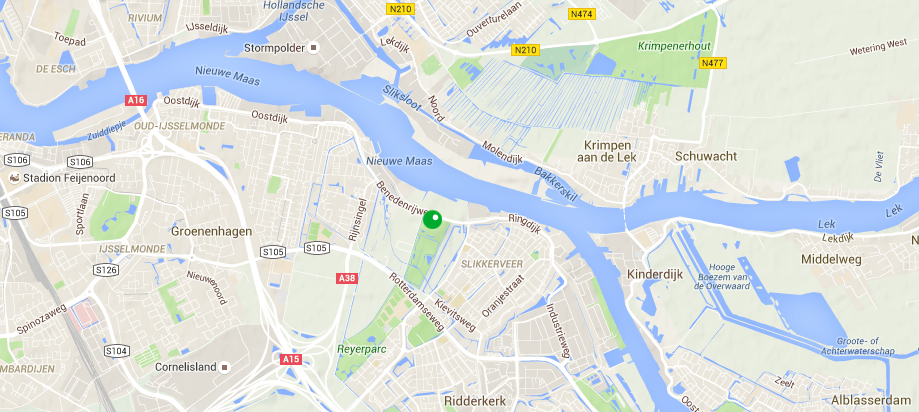
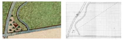
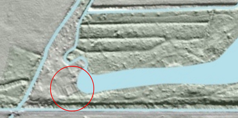
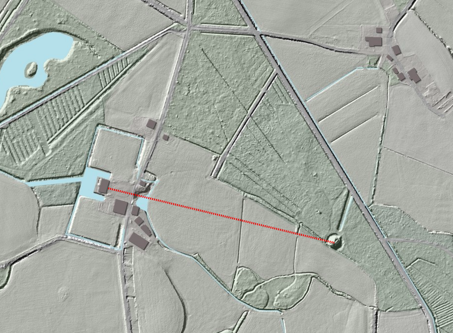
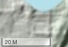
Ervan uitgaande dat hier geen sprake is van een anomalie in het beeld, wijst een ruwe schatting mijnerzijds uit dat de piramide van Huys ten Donck een basis had van 5 à 10 meter -afhankelijk van de vraag op welke manier de AHN2-gegevens moeten worden geïnterpreteerd. 4Waarbij het tevens raadzaam is in aantallen ‘voeten’ en ‘roeden’ te rekenen, in plaats van meters. Het heeft er daarbij alle schijn van, dat de piramide exact in een noord-zuid/oost-west richting was geplaatst.
Nader onderzoek in het veld zou daar uitsluitsel over moeten kunnen geven en hopelijk ook resten van de piramide kunnen opleveren, in plaats van alleen maar sporen. Daarbij zou eveneens vastgesteld kunnen worden of het hier inderdaad gaat om de piramide, of eventueel een ander -vooralsnog onbekend- bouwwerk. Het feit dat hij twee jaar na aanleg van de vijver nog werd genoemd, wijst wat mij betreft in de richting van de piramide.
Schermafbeelding 2015-11-21 om 21.09.40

Locatie van Huys ten Donck, ten zuid-oosten van Rotterdam.

Footnotes

Footnotes
1 Maar ze geven zelf ook al aan dat de resultaten van hun metingen meerdere toepassingen kunnen hebben: “Ook gemeenten, bedrijven en onderzoekers gebruiken de gedetailleerde hoogtegegevens. Zo hebben archeologen aan de hand van kleine hoogteverschillen in weilanden, die ze met het AHN zichtbaar maakten, oude nederzettingen opgespoord die voor het blote oog niet opvielen.”
Een variant van dat laatste is onderwerp van dit bericht.
2 Hartelijke dank aan Laura Fokkema voor het aanreiken van deze bron, die ook -juist- in het veld bijzonder bruikbaar is.
3 Stadsarchief Rotterdam, toegang 30, inv.nr. 63.
Ary Punt was op dat moment rentmeester van Huys ten Donck, maar wat het ‘oppassen’ precies betekent is in dit geval onduidelijk. De term werd vaker gebruikt in kasboeken van Huys ten Donck, maar dan vooral met betrekking tot de bedienden die het huis gedurende de wintermaanden in de gaten hielden, schoonhielden en -in het voorjaar- luchtten.
Niet uit te sluiten valt dat de piramide moest worden beschermd wegens (graaf)werkzaamheden tijdens de aanleg van de nieuwe vijver in 1792. Maar de basis van de piramide lijkt zich te bevinden op de plaats waar de slingerende sloot vóór de aanleg van de vijver liep. Daarmee is een verplaatsing van het gebouwtje het meest realistische scenario.
4 Waarbij het tevens raadzaam is in aantallen ‘voeten’ en ‘roeden’ te rekenen, in plaats van meters.
Summary

Laser altimetry technology reveals the location of what is most probably the footprint of a lost garden pyramid in The Netherlands. It seems to be several meters north from the location indicated on maps from the 1780’s, but it may have been moved towards the bank of the pond after that was created in 1792.
Until further on-site research is done, the idea that this shape is merely the result of an anomaly in the picture, can not be completely ruled out, though.

Continue reading

Donauweibchen, not Venus

Apart from being the name of an 1887 waltz by Johann Strauss, the name Donauweibchen probably does not ring too many bells. The name refers to a legendary nymph, who brought good luck to the fishermen of the Danube river near Vienna.
It is no surprise then, that Vienna boasts several statues of this nymph. One statue, created by Hanns Gasser (1817-1868), was unveiled in 1865 as the first statue in the Wiener Stadtpark -although it was originally created in 1858 and intended for a different location in the city. 1In the mean time, a bronze fountain with a Donauweibchen as the top figure -holding a fish in her right hand- designed by Heinrich von Ferstel had been erected in a bank building in 1861. The fountain is still there in what is now called Palais Ferstel.
Up till 1860, Gasser was Vienna’s most celebrated sculptor. The last years of his life a neglected injury to his right hand increasingly impaired his ability to sculpt -his studio had to take over. (W. Krause, ‘Han(n)s Gasser’, in Saur, Allgemeines Künstler Lexikon, Band 50 (June 2006), p.52).
In 1948 the war-damaged original was replaced by a copy. A few other copies of this statue, as well as other versions, are situated elsewhere in Vienna.

Donauweibschen SoestdijkWhere one would not necessarily expect to see an exact copy of Gasser’s statue, is in a garden in the Netherlands, surprisingly not even close to that other large European river, the Rhine.
That might explain why Paleis Soestdijk, the garden in question, provides a wrong identification of the statue. In their guide book she is identified as a Venus, 2Katelijne Eissens / Kunsthistorisch Bureau D’Arts, Paleis Soestdijk. Wandeling door het Park (Rijksgebouwendienst Den Haag, 2011), p.36-37. even though Wim Meulenkamp had already correctly identified the statue as a representation of the Donauweibchen in 2008 -in a publication commissioned by the same organisation. 3Wim Meulenkamp, Cementrustieke brug tegenover het Prinses Wilhelmina châlet in het park van Paleis Soestdijk: maker, techniek, herstel en waardebepaling; met opmerkingen over de kunstrotsen in de nabijheid van de brug en de basis van het Donauweibchen vóór de kassen of bloemserres, (Rijksgebouwendienst Den Haag, 2008).

Donauweibschen Soestdijk detailI must confess that I didn’t see it immediately either, and wouldn’t have come up with the name myself. As obvious as it was that the Yorke House Venus just couldn’t be one of the nymphs, as unclear to me the iconography was here.
But as soon as one notices the two fishes sculpted in her lap, just above the line of her garment, any identification with Venus is out the window.

The description in the national register of monuments cleverly remains neutral about the identification, but most probably reads the monogram on one of the shields at the foot of the statue wrong (HC, where HG would make more sense):

Op een rotsachtig basement is een marmeren beeld, een mythologisch of allegorisch vrouwenfiguur, geplaatst. Aan haar voet staat een boomstam met twee gekoppelde heraldische wapens en een klein wapenschildje met het monogram HC en het jaartal 1858. 4The ‘image library’ (beeldbank) -operated by the same national cultural heritage agency (RCE)- consistently calls her Venus, though.

Based on the date on the statue, the register of monuments claims the area it sits in was designed and laid out around 1858. But we already saw that even the original statue of Hanns Gasser was not unveiled in Vienna until seven years later. In that same year, 1865, prince Willem Frederik Hendrik (1820-1879) inherited Soestdijk, his place of birth. Prince Hendrik had been appointed governor (stadhouder) of the Duchy of Luxembourgh in 1850, where he resided at Castle Walferdange. Soestdijk was meant to be his summer residence.
Perhaps the statue, newly unveiled in its hometown Vienna, was a celebratory gift for prince Hendrik, to adorn his new garden at Paleis Soestdijk?

Locatie Paleis Soestdijk

Location of Paleis Soestdijk, to the north east of Utrecht.

Footnotes

Footnotes
1 In the mean time, a bronze fountain with a Donauweibchen as the top figure -holding a fish in her right hand- designed by Heinrich von Ferstel had been erected in a bank building in 1861. The fountain is still there in what is now called Palais Ferstel.
Up till 1860, Gasser was Vienna’s most celebrated sculptor. The last years of his life a neglected injury to his right hand increasingly impaired his ability to sculpt -his studio had to take over. (W. Krause, ‘Han(n)s Gasser’, in Saur, Allgemeines Künstler Lexikon, Band 50 (June 2006), p.52).
2 Katelijne Eissens / Kunsthistorisch Bureau D’Arts, Paleis Soestdijk. Wandeling door het Park (Rijksgebouwendienst Den Haag, 2011), p.36-37.
3 Wim Meulenkamp, Cementrustieke brug tegenover het Prinses Wilhelmina châlet in het park van Paleis Soestdijk: maker, techniek, herstel en waardebepaling; met opmerkingen over de kunstrotsen in de nabijheid van de brug en de basis van het Donauweibchen vóór de kassen of bloemserres, (Rijksgebouwendienst Den Haag, 2008).
4 The ‘image library’ (beeldbank) -operated by the same national cultural heritage agency (RCE)- consistently calls her Venus, though.
Summary

In de tuin van Paleis Soestdijk staat een beeld, dat ten onrechte als een beeld van Venus wordt aangemerkt. Wim Meulenkamp schreef al dat het hier gaat om het zgn. Donauweibchen, een nimf die volgens de legende vissers bij Wenen zou hebben beschermd (en betoverd door haar schoonheid). Het beeld is een kopie van een beeld in Wenen, van de beeldhouwer Hanns Gasser.
Hier wordt het jaar 1865 als plaatsingsdatum voorgesteld, het jaar waarin prins Hendrik (de Zeevaarder) Soestdijk erfde -tevens het jaar waarin het Weense origineel werd onthuld.

Continue reading

Huys ten Donck’s huisje van Wilhelm Tell gedateerd

c1820 HtD Wilhelm Tell
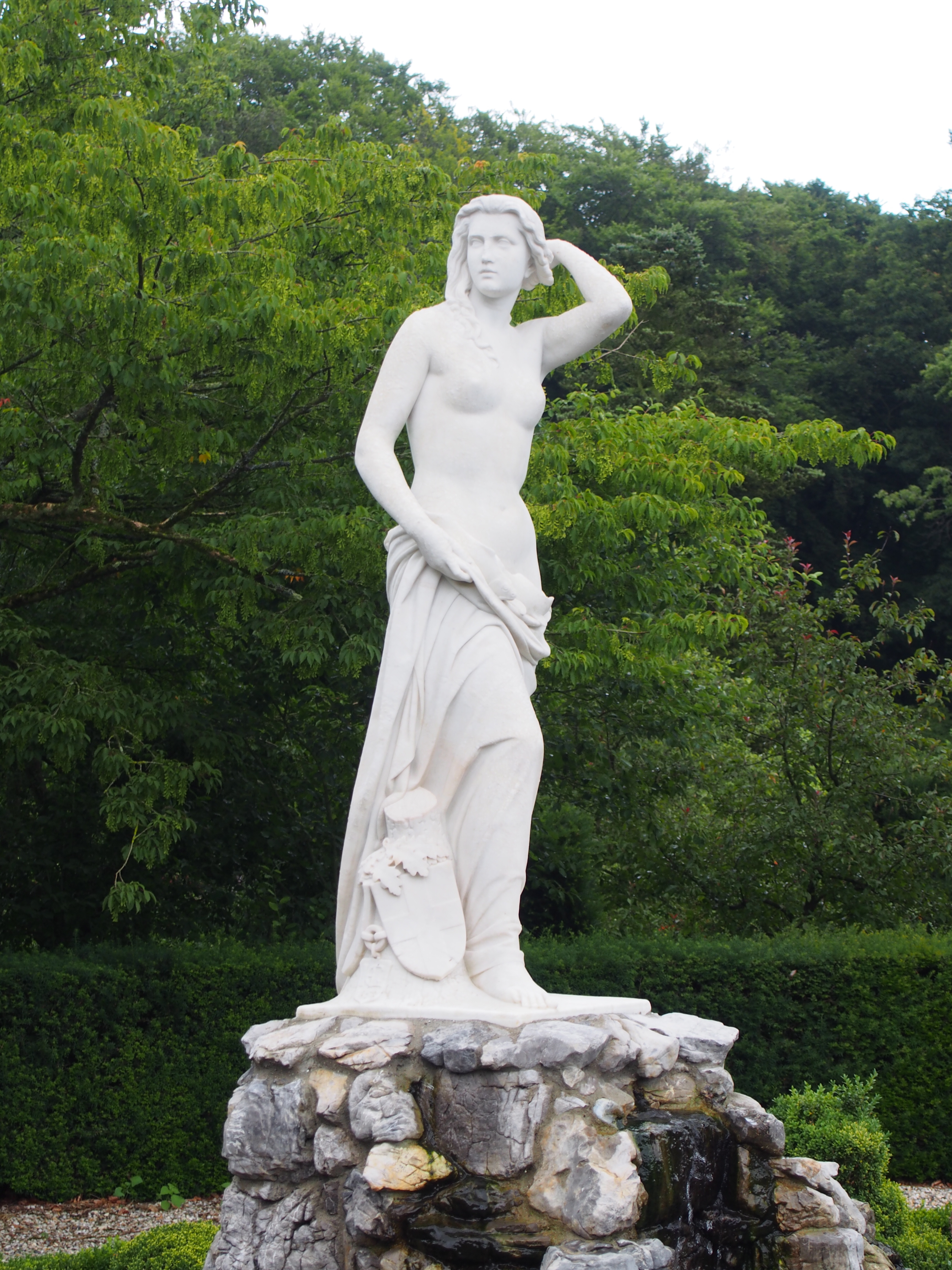
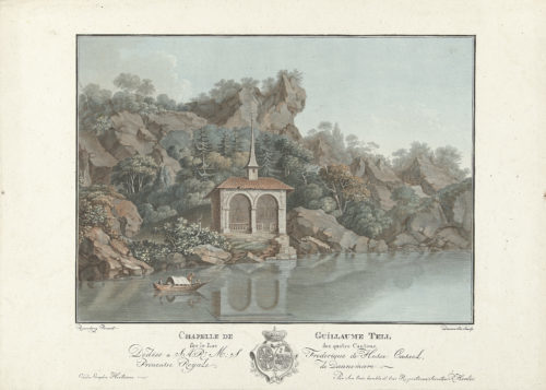
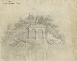
In het park van Huys ten Donck stond ooit een tuingebouw, dat wel werd aangeduid als ‘het huisje van Wilhelm Tell’. De bouwdatum ervan is niet bekend, volgens Tromp ‘waarschijnlijk van ca. 1800.'1H.M.J. Tromp, De Nederlandse Landschapsstijl in de Achttiende Eeuw (Leiden 2012), p348.
Het is inmiddels verdwenen, maar gelukkig is er wel een afbeelding van. Op een anoniem schilderij uit ca. 1820 staat het in de verte als klein detail afgebeeld.

In het archief van Huys ten Donck wordt een tekening bewaard van de Tellskapelle, zoals hij aan de oever van de Vierwaldstättersee staat (destijds ook ‘meer van Lucerne’ genoemd).2Stadsarchief Rotterdam (SAR), Toegang 30, inv.nr. 122. Volgens de inventaris dateert de tekening van 1815, maar dat moet uit de context zijn gebleken: op de tekening zelf is van een datering geen spoor. De tekening staat ook afgebeeld in: I. Thoen, Het Huys ten Donck en de familie Groeninx van Zoelen (Rotterdam 2006), p85. In het bijschrift wordt de tekening toegeschreven aan Jacoba Elisabeth Groeninx van Zoelen, maar dat was een jong overleden zus van Otto Paulus. Deze tekening werd gemaakt door Elisabeth Cornelie Groeninx van Zoelen, een in 1818 op 20-jarige leeftijd overleden dochter van Otto Paulus Groeninx van Zoelen. De overeenkomsten met de echte Tellskapelle zijn groot.3De huidige kapel is gebouwd in 1879, maar een foto, gepubliceerd in of voor 1870, toont aan dat de kapel niet wezenlijk van uiterlijk is veranderd.
Otto Paulus Groeninx van Zoelen reisde met zijn hele familie tussen 11 april 1810 en 23 juni 1812 door Europa, en verbleef volgens zijn opgave 150 dagen in Geneve.4SAR, Toegang 30, inv.nr. 84. Hoewel dat aan een ander meer ligt, kan Elisabeth (‘Betsy’) deze tekening dus ter plaatse gemaakt hebben.5Nader onderzoek in de behoorlijke hoeveelheid aan correspondentie die uit deze periode bewaard is gebleven, kan daar uitsluitsel over geven.
Er zou wel een schilderij van de legende van Tell in het huisje hebben gehangen (zie noot 10). Mogelijk stond de kapel daarop afgebeeld, en is deze tekening niet ‘naar het leven’ gemaakt.

BetsY_Tell

Tellskapelle, tekening door Elisabeth Cornelie Groeninx van Zoelen, c1815? (Foto: Stadsarchief Rotterdam)

Het ‘Capelleke Buyten’
Maar moet de datering van dat huisje dan richting 1815 worden verschoven? Continue reading

Footnotes

Footnotes
1 H.M.J. Tromp, De Nederlandse Landschapsstijl in de Achttiende Eeuw (Leiden 2012), p348.
2 Stadsarchief Rotterdam (SAR), Toegang 30, inv.nr. 122. Volgens de inventaris dateert de tekening van 1815, maar dat moet uit de context zijn gebleken: op de tekening zelf is van een datering geen spoor. De tekening staat ook afgebeeld in: I. Thoen, Het Huys ten Donck en de familie Groeninx van Zoelen (Rotterdam 2006), p85. In het bijschrift wordt de tekening toegeschreven aan Jacoba Elisabeth Groeninx van Zoelen, maar dat was een jong overleden zus van Otto Paulus.
3 De huidige kapel is gebouwd in 1879, maar een foto, gepubliceerd in of voor 1870, toont aan dat de kapel niet wezenlijk van uiterlijk is veranderd.
4 SAR, Toegang 30, inv.nr. 84.
5 Nader onderzoek in de behoorlijke hoeveelheid aan correspondentie die uit deze periode bewaard is gebleven, kan daar uitsluitsel over geven.
Er zou wel een schilderij van de legende van Tell in het huisje hebben gehangen (zie noot 10). Mogelijk stond de kapel daarop afgebeeld, en is deze tekening niet ‘naar het leven’ gemaakt.
Summary

At Huys ten Donck, the building date of a now lost garden pavilion resembling Wilhelm Tell’s ‘kapelle’ on the rocky shores of the Vierwaldstättersee in Switzerland, was unknown. The estimate was that it was built circa 1800, although the layout of the garden it sat in, is known to have taken place in 1792.
One document in the house archive -a hand written version of the legend of Wilhelm Tell- mentions that this pavilion had just been built. This document is dated 29 September 1792. Earlier that year, a carpenter was paid ƒ219,- for his work on the ‘Capelleke Buyten’.
Both documents confirm that the pavilion was built simultaneously with the creation of this new layout of the garden (the ‘nieuwe werk’).

Continue reading