Six years ago I wrote a small piece about a peculiar elevation in the garden of Wegdam, near Goor in the Netherlands. A ‘hill’ I called it earlier, but it can’t be much more than 5 meters high. The problem at the time was that it was difficult to present my case, partly because topographical maps did not indicate there wás an elevation before 1989.
Enter a source I have used earlier this year: the Actueel Hoogtebestand Nederland (AHN). That same technology shows the elevation at Wegdam in all its glory, as well as the ‘canal’ leading up to it from the road. 1This body of water is not coloured blue on the AHN, but the image shows where the ground level is lower.
This view immediately clarifies the point I was trying to make: that it was and is situated in the central axis leading into the garden from the front door. And thus must have been a deliberate part of the garden’s design.
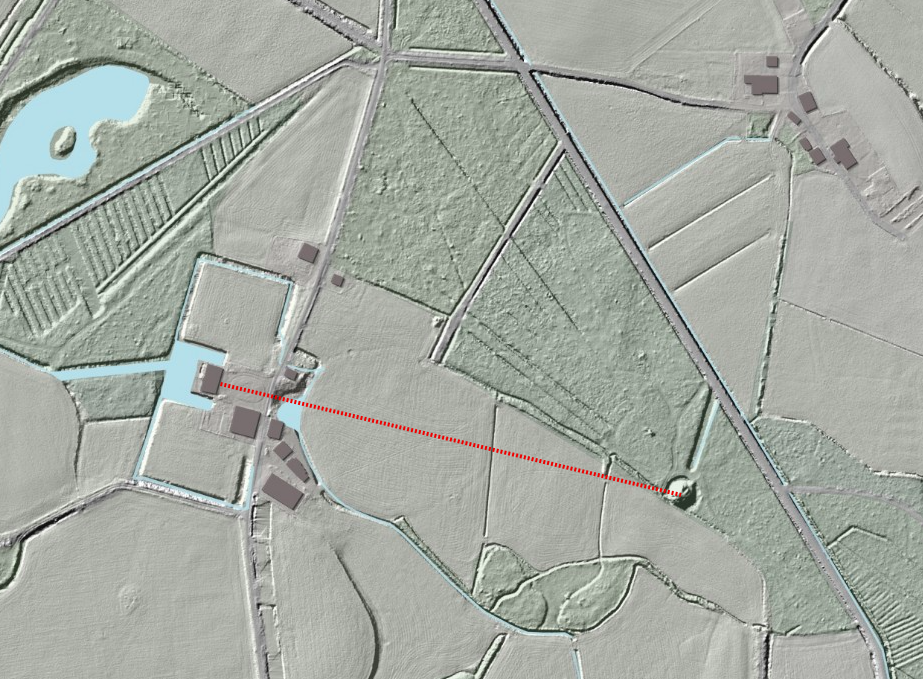
Wegdam as seen on the Actueel Hoogtebestand Nederland (AHN). The central axis is indicated by the red dotted line.
Looking towards the northeast, the stretch of water would have lead the visitor’s eye between the buildings of a farm, further into the countryside. A turn to the west would have given a view of the house. It would have been a perfect belvedere. The questions from six years ago (when was the hill created -the AHN doesn’t solve that issue; was there ever a building or structure on top of it?) remain unanswered till this day. 2Provided I have not missed anything in a local publication.
The image above leads to a new question, though: near the top there is a junction of two roads, forming an irregular ‘cross’ sign with four arms. But the LIDAR imagery of the AHN shows at least five extra straight lines radiating from this junction. Could this be an indication the area has been used as hunting ground, with a sterrenbos as its centre? Maps over the past 200 years do not show this feature, which means that if this was a sterrenbos, it must have been older than that.
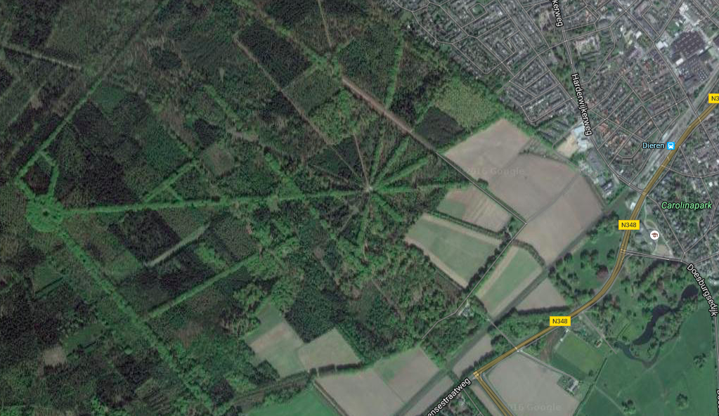
Aerial view of the Carolinaberg in Dieren, an example of a sterrenbos created for hunting purposes. It boasts 14 straight avenues radiating from the centre.

